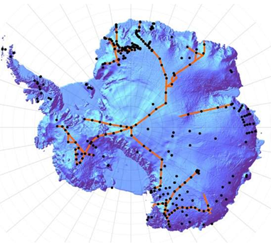
File:Figure 2.4 - Map of Antarctic ice cores and ground penetrating radar routes.png
From ACCE
Revision as of 15:31, 6 August 2014 by Maintenance script (Talk)
Figure_2.4_-_Map_of_Antarctic_ice_cores_and_ground_penetrating_radar_routes.png (381 × 342 pixels, file size: 206 KB, MIME type: image/png)
Location of Antarctic ice cores (black dots) and ground penetrating radar (GPR) routes (red lines) from Ice READER.
File history
Click on a date/time to view the file as it appeared at that time.
| Date/Time | Thumbnail | Dimensions | User | Comment | |
|---|---|---|---|---|---|
| current | 15:31, 6 August 2014 |  | 381 × 342 (206 KB) | Maintenance script (Talk) | Uploaded by import script |
- You cannot overwrite this file.
File usage
The following page links to this file:
