File:Figure 4.25 - Amundsen Sea bathymetric chart and hydrographic stations of different cruises.png
From ACCE
Revision as of 15:30, 6 August 2014 by Maintenance script (Talk)
No higher resolution available.
Figure_4.25_-_Amundsen_Sea_bathymetric_chart_and_hydrographic_stations_of_different_cruises.png (637 × 481 pixels, file size: 343 KB, MIME type: image/png)
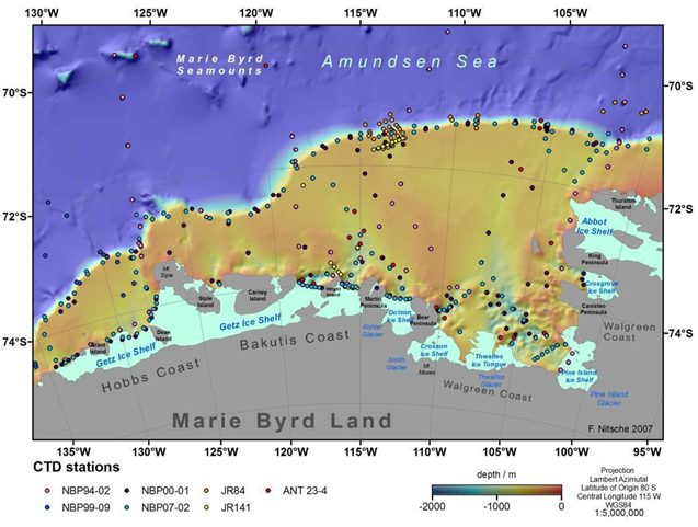
Bathymetric chart of the Amundsen Sea continental shelf and adjacent deep ocean spotted with the distribution of hydrographic stations of different cruises (colour coded). Fringing ice shelves and glaciers draining the West Antarctic Ice Sheet in light blue (Nitsche et al., 2007[1]). The CTD station identifiers refer to the Nathaniel B. Palmer (NBP), the James Clark Ross (JCR) and the Polarstern (ANT).
- ↑ Nitsche, F.O., Jacobs, S.S., Larter, R.D. and Gohl, K. 2007. Bathymetry of the Amundsen Sea continental shelf: Implications for geology, oceanography, and glaciology, Geochem. Geophys. Geosyst., 8, Q10009, doi:10.1029/2007GC001694.
File history
Click on a date/time to view the file as it appeared at that time.
| Date/Time | Thumbnail | Dimensions | User | Comment | |
|---|---|---|---|---|---|
| current | 15:30, 6 August 2014 | | 637 × 481 (343 KB) | Maintenance script (Talk) | Uploaded by import script |
- You cannot overwrite this file.
File usage
The following page links to this file: