File:Figure 3.19b - Map showing GISP2, Siple Dome and key atmospheric circulation features.png
From ACCE
Revision as of 15:31, 6 August 2014 by Maintenance script (Talk)
No higher resolution available.
Figure_3.19b_-_Map_showing_GISP2,_Siple_Dome_and_key_atmospheric_circulation_features.png (384 × 463 pixels, file size: 251 KB, MIME type: image/png)
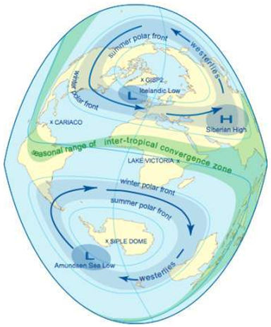
Map showing location of GISP2, Siple Dome, Icelandic Low, Siberian High, Amundsen Sea Low, Intertropical Convergence Zone, and westerlies in both hemispheres.
File history
Click on a date/time to view the file as it appeared at that time.
| Date/Time | Thumbnail | Dimensions | User | Comment | |
|---|---|---|---|---|---|
| current | 15:31, 6 August 2014 | | 384 × 463 (251 KB) | Maintenance script (Talk) | Uploaded by import script |
- You cannot overwrite this file.
File usage
The following page links to this file: