File:Figure 2.34 - Nested grids, with ice thickness fields, for the UMISM.png
From ACCE
Revision as of 15:31, 6 August 2014 by Maintenance script (Talk)
No higher resolution available.
Figure_2.34_-_Nested_grids,_with_ice_thickness_fields,_for_the_UMISM.png (476 × 457 pixels, file size: 315 KB, MIME type: image/png)
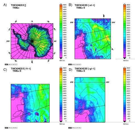
Nested grids, with ice thickness fields, for the UMISM. (A), the full ice sheet at 40 km resolution; (B), a medium resolution, 10 km grid encompassing the whole airborne geophysical dataset (shown in Figure 2.33); full 5 km resolution grids for (C) Pine Island Glacier and (D) Thwaites Glacier. Color elevation scale is shown at right.
File history
Click on a date/time to view the file as it appeared at that time.
| Date/Time | Thumbnail | Dimensions | User | Comment | |
|---|---|---|---|---|---|
| current | 15:31, 6 August 2014 | | 476 × 457 (315 KB) | Maintenance script (Talk) | Uploaded by import script |
- You cannot overwrite this file.
File usage
The following page links to this file: