File:Figure 2.26 - Permafrost distribution by form in the McMurdo Dry Valleys.png
From ACCE
No higher resolution available.
Figure_2.26_-_Permafrost_distribution_by_form_in_the_McMurdo_Dry_Valleys.png (553 × 716 pixels, file size: 498 KB, MIME type: image/png)
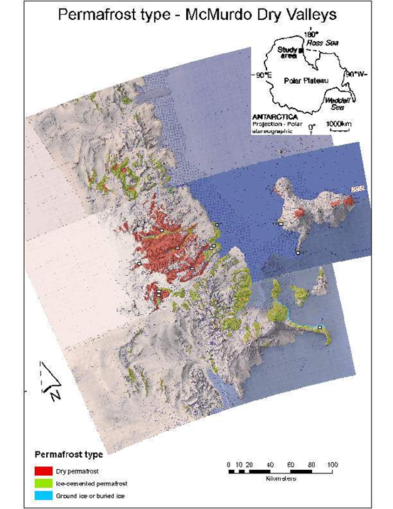
Reconnaissance map (1:2 million scale) showing permafrost distribution by form in the McMurdo Dry Valleys (Bockheim et al., 2007[1]). Squares show Circumpolar Active-Layer Monitoring – South (CALM-S) sites.
- ↑ Bockheim, J.G., I.B. Campbell, and M. McLeod. 2007. Permafrost distribution and active-layer depths in the McMurdo Dry Valleys, Antarctica. Permafrost and Periglacial Processes: In Press.
File history
Click on a date/time to view the file as it appeared at that time.
| Date/Time | Thumbnail | Dimensions | User | Comment | |
|---|---|---|---|---|---|
| current | 15:31, 6 August 2014 | | 553 × 716 (498 KB) | Maintenance script (Talk) | Uploaded by import script |
- You cannot overwrite this file.
File usage
The following page links to this file: