Difference between revisions of "File:Figure 1.5 - Antarctic ice thickness.png"
From ACCE
(Uploaded by import script) |
(No difference)
|
Latest revision as of 15:31, 6 August 2014
Ice thickness (difference between surface and bed elevations) in metres, showing the much thicker East Antarctic ice sheet, gradual thinning from the interior to the coast and the many deep outlet glaciers. Seawards of the continental outline, the dark blue areas are the permanent ice shelves that represent floating extensions of the continental ice sheet. From Lythe, Vaughan and BEDMAP Consortium, 2001.
File history
Click on a date/time to view the file as it appeared at that time.
| Date/Time | Thumbnail | Dimensions | User | Comment | |
|---|---|---|---|---|---|
| current | 15:31, 6 August 2014 | 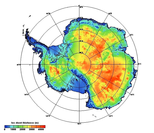 | 624 × 542 (347 KB) | Maintenance script (Talk) | Uploaded by import script |
- You cannot overwrite this file.
File usage
The following page links to this file: