Difference between revisions of "File:Figure 1.4 - Antarctic bed elevation.png"
From ACCE
(Uploaded by import script) |
(No difference)
|
Latest revision as of 15:31, 6 August 2014
Bed elevation illustrating major regions (in blue and green) below sea level, the major subglacial continent underneath East Antarctica, and the mountain ranges separating East and West Antarctica and along the Antarctic Peninsula. Note the topography shown here has not been corrected for isostatic rebound. Taken from Lythe, Vaughan and BEDMAP Consortium, 2001.
File history
Click on a date/time to view the file as it appeared at that time.
| Date/Time | Thumbnail | Dimensions | User | Comment | |
|---|---|---|---|---|---|
| current | 15:31, 6 August 2014 | 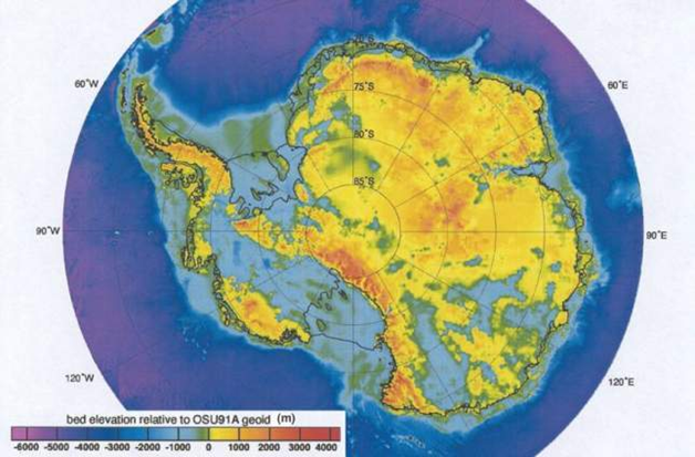 | 628 × 413 (414 KB) | Maintenance script (Talk) | Uploaded by import script |
- You cannot overwrite this file.
File usage
The following page links to this file: