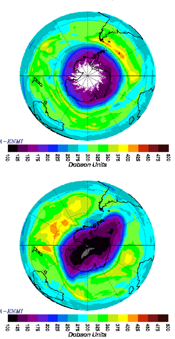
File:Figure 4.16 - Aura satellite Ozone Monitoring Instrument measurements on 14 Sep 2006 and 10 Oct 2006.png
From ACCE
Revision as of 14:31, 6 August 2014 by Maintenance script (Talk)
Figure_4.16_-_Aura_satellite_Ozone_Monitoring_Instrument_measurements_on_14_Sep_2006_and_10_Oct_2006.png (356 × 688 pixels, file size: 176 KB, MIME type: image/png)
Measurements by the Ozone Monitoring Instrument on the Aura satellite, with a scale in DU. Top – on 14 September 2006, showing an almost symmetric ozone hole covering all of Antarctica. Bottom – on 10 October 2006, showing the ozone hole extending towards South America. (courtesy NASA/GSFC).
File history
Click on a date/time to view the file as it appeared at that time.
| Date/Time | Thumbnail | Dimensions | User | Comment | |
|---|---|---|---|---|---|
| current | 14:31, 6 August 2014 |  | 356 × 688 (176 KB) | Maintenance script (Talk) | Uploaded by import script |
- You cannot overwrite this file.
File usage
The following page links to this file:
